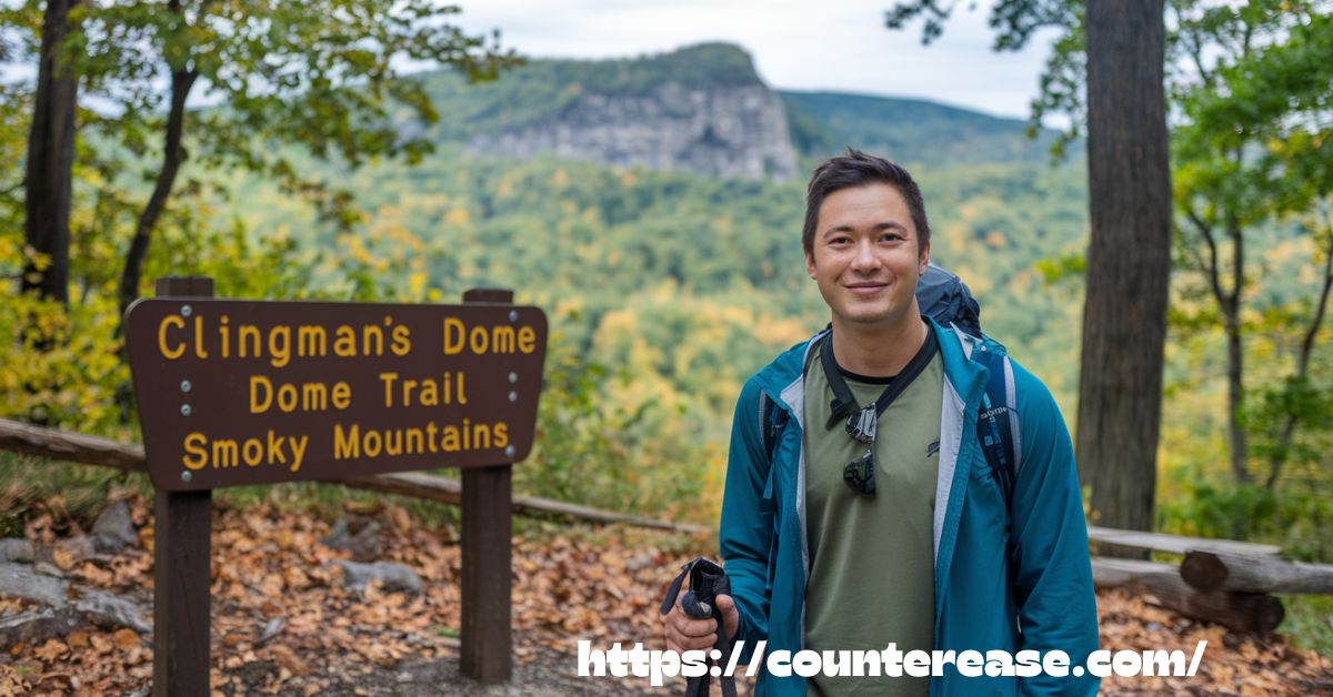
The Kuwohi-Clingmans Dome Trail is a breathtaking high-altitude hiking path in the Great Smoky Mountains National Park. Leading to the highest point in Tennessee at 6,643 feet, this scenic trail offers a paved but steep ascent through a lush spruce-fir forest. Formerly known only as Clingmans Dome, the name Kuwohi honors the area’s Cherokee heritage. The kuwohi clingmans dome trail culminates at an iconic observation tower, providing a panoramic 360-degree view of the surrounding mountains, valleys, and endless blue ridges stretching into the horizon.
Few trails offer an experience as exhilarating as Kuwohi-Clingmans Dome. Each step takes hikers closer to the sky, where crisp mountain air and ever-changing vistas create an unforgettable journey. Morning mist drapes the peaks like a dream, while autumn transforms the trail into a vibrant spectacle of fiery foliage. Whether bathed in golden sunrise hues or framed by winter’s frost, this trail presents nature’s beauty in its purest form.
More than just a hike, the Kuwohi-Clingmans Dome Trail is a gateway to adventure, history, and awe-inspiring scenery. On clear days, the view extends over 100 miles, making the challenging incline well worth the effort. With well-maintained pathways, seasonal accessibility, and a rich ecological landscape, this legendary kuwohi clingmans dome trail remains a must-visit for outdoor enthusiasts, photographers, and those seeking a deeper connection with the Smoky Mountains.
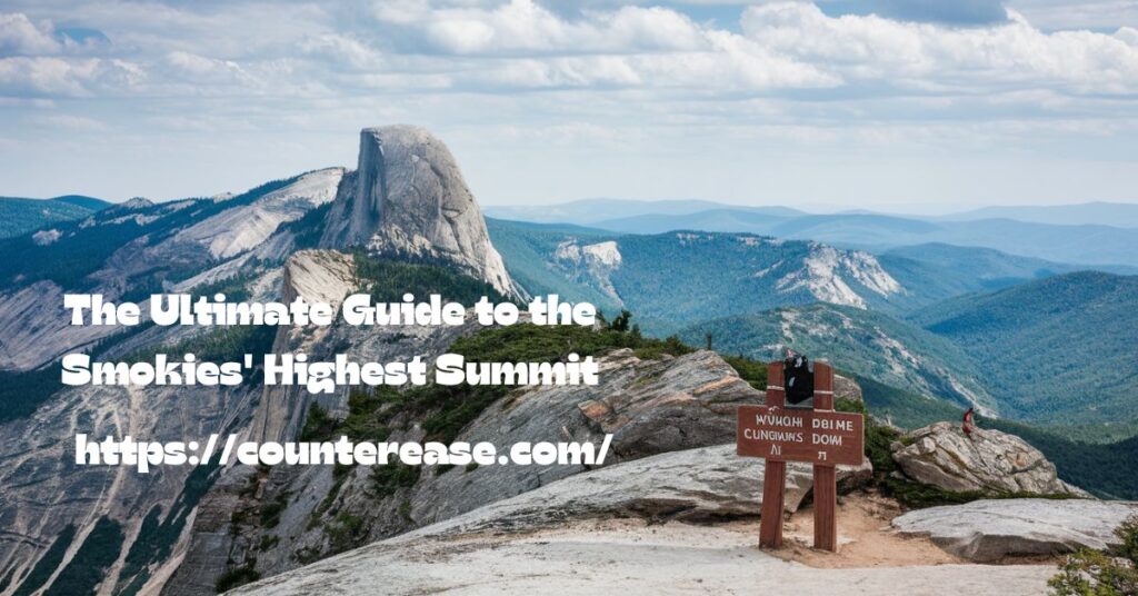
The Ultimate Guide to the Smokies’ Highest Summit
Standing atop the highest point in Tennessee, with clouds drifting below and mountain ridges stretching to the horizon in every direction—that’s the magic of Kuwohi Trail (formerly known as Clingmans Dome). This iconic destination in Great Smoky Mountains National Park offers one of the most spectacular panoramic experiences in the eastern United States, rewarding visitors with 360-degree views that can stretch up to 100 miles on clear days.
Whether you’re planning your first visit or returning to experience this lofty peak in a different season, this comprehensive guide will help you make the most of your journey to the rooftop of the Smokies.
Exploring Kuwohi Trail: Introduction to Kuwohi (Clingmans Dome)
At an impressive elevation 6,643 feet, Kuwohi stands as the highest peak not just in Tennessee but throughout the entire Great Smoky Mountains National Park. The name “Kuwohi,” meaning “Mulberry Place” in Cherokee, reflects the recent and significant restoration of Cherokee heritage to this culturally important location.
In 2023, the U.S. Board on Geographic Names officially recognized the traditional Cherokee name alongside the historical name of Clingmans Dome, acknowledging the mountain’s deep significance to the Cherokee people who called these mountains home long before European settlement.
“Returning the Cherokee name Kuwohi to this special place helps honor the deep and enduring relationship between the Cherokee people and their ancestral lands in the Smokies.” — Eastern Band of Cherokee Indians Principal Chief Richard Sneed
The mountain’s summit features a distinctive observation tower that rises 54 feet, allowing visitors to elevate above the surrounding spruce-fir forest for unobstructed views. On exceptionally clear days, visitors can glimpse parts of seven states—Tennessee, North Carolina, South Carolina, Georgia, Kentucky, Virginia, and Alabama.
Beyond the views, kuwohi clingmans dome trail represents a unique ecosystem within the park. The Spruce-Fir forest surrounding the peak creates an environment more similar to Canadian forests than what you’d typically find in the southeastern United States. Kuwohi clingmans dome trail high-elevation environment hosts rare species and provides a glimpse into how climate influences plant and animal communities.
See Also: 5 Beautiful Waterfalls in Mercer County, West Virginia
Essential Planning Information

Best Times to Visit
Timing your visit to Kuwohi requires understanding both seasonal accessibility and optimal viewing conditions:
| Season | Road Status | Crowd Levels | View Quality | Temperature |
|---|---|---|---|---|
| Spring (Apr-May) | Often open by April | Moderate | Variable, frequent fog | 40-60°F |
| Summer (Jun-Aug) | Fully open | Very high | Hazy, afternoon storms | 60-70°F |
| Fall (Sep-Nov) | Open until Nov 30 | Extremely high | Excellent, esp. mornings | 40-65°F |
| Winter (Dec-Mar) | Closed to vehicles | Very low | Exceptional clarity | 20-40°F |
The Kuwohi Road (formerly Clingmans Dome Road) typically closes from December 1 through March 31 due to unpredictable winter conditions. During this closure period, adventurous visitors can still access the area on foot or by cross-country skiing, offering a rare opportunity for high-elevation solitude.
Parking and Access Requirements
As of 2023, Great Smoky Mountains National Park implemented a parking tag system that affects visitors to Kuwohi:
- Daily Parking Tags: $5 per day
- Weekly Parking Tags: $15 for 7 consecutive days
- Annual Parking Tags: $40 for one year from purchase date
These parking tags can be purchased online through the park’s official website, at visitor centers, or through the Recreation.gov app. They must be displayed in your vehicle while parked anywhere in the park, including the Kuwohi parking area.
Notably, parking at Kuwohi can fill up quickly, especially during peak fall foliage season and summer weekends. Arriving before 9 am or after 4 pm significantly increases your chances of finding a spot without lengthy waits.
Road Closures and Alternate Access
The 7-mile Kuwohi Road branches off Newfound Gap Road (US-441) and climbs to the trailhead parking area. During road closures, several alternate access options exist:
- Winter Hiking: The road itself becomes a hiking trail when closed to vehicles. Plan for a 14-mile round trip from Newfound Gap.
- Appalachian Trail Access: Advanced hikers can reach Kuwohi via the Appalachian Trail, which crosses directly over the mountain.
- Forney Ridge Trailhead connections offer longer backpacking approaches for the adventurous.
For those seeking accessibility information, the National Park Service has designated the main paved trail to the observation tower as “accessible with assistance.” The 0.5-mile path has a steep grade of 8-12%, making independent wheelchair navigation challenging but possible with strong companions.
Weather Considerations for a Successful Visit
The weather at Kuwohi creates both its challenges and its magic. Due to its elevation, the peak experiences temperature variations of 10-15 degrees cooler than surrounding lowland areas. This microclimate can surprise unprepared visitors, especially as conditions can change rapidly.
Weather conditions at the summit often include:
- Frequent cloud cover (the mountains create their own weather)
- Swift-moving fog banks that can reduce visibility to near zero in minutes
- Strong winds, particularly at the observation tower
- Sudden afternoon thunderstorms during summer months
- Rime ice formations in winter that transform the landscape into a crystalline wonderland
Smart visitors check the dedicated Kuwohi webcam (available on the National Park Service website) before departing for real-time conditions. Cell service is spotty throughout the park, so downloading weather information before your trip is advisable.
What to pack for changing conditions:
- Layered clothing regardless of season
- Waterproof outer layer, even on seemingly clear days
- Hat and sunscreen (UV exposure increases with elevation)
- Extra water (the cool air can mask dehydration)
- Camera with lens cleaning cloth (moisture and fog can affect lenses)
Accessing Kuwohi/Clingmans Dome
Driving Directions
From Gatlinburg, Tennessee:
- Take Newfound Gap Road (US-441) south toward Cherokee, NC
- Drive approximately 23 miles to the signed junction for Kuwohi Road
- Turn right onto Kuwohi Road and continue 7 miles to the parking area
- Total driving time from Gatlinburg: approximately 1 hour
From Cherokee, North Carolina:
- Take Newfound Gap Road (US-441) north toward Gatlinburg, TN
- Drive approximately 20 miles to the signed junction for Kuwohi Road
- Turn left onto Kuwohi Road and continue 7 miles to the parking area
- Total driving time from Cherokee: approximately 1 hour
The drive along Kuwohi Road itself is considered one of the park’s most scenic scenic drives, with several pullouts offering spectacular Sugarland Mountain vistas and views toward the Elkmont area. Watch for wildlife, particularly in early morning and late evening hours, when black bears, deer, and wild turkeys may be spotted.
Parking Area Details
The main parking area accommodates approximately 200 vehicles, but this often proves insufficient during peak periods. Rangers sometimes implement a one-in, one-out system during extremely busy days.
Parking area amenities include:
- Restroom facilities near the trailhead
- Information boards with park maps and alerts
- Several picnic tables in nearby clearings
- A small visitor center with educational displays
- Connecting paths to the Appalachian Trail and Forney Ridge Trail
For those utilizing the park’s accessibility services, several designated accessible parking spaces are available closest to the trailhead.
Facilities and Amenities

Visitor Center and Facilities
The Kuwohi visitor center typically operates from April through November, offering interpretive exhibits about the area’s natural and cultural history. While smaller than the park’s main visitor centers, it provides valuable context about the unique Spruce-Fir forest ecosystem and the challenges it faces from non-native insects and changing climate conditions.
Trailhead amenities include:
- Flush toilet restrooms (seasonal, typically closed in winter)
- Water fountains (seasonal, not available during winter months)
- Information kiosks with maps and current conditions
- Covered seating areas for weather protection
- A small gift shop with basic supplies and souvenirs
It’s worth noting that there are no food services at Kuwohi, so bringing snacks and water is essential. The nearest food options are in Newfound Gap (vending machines only) or back in the gateway communities of Gatlinburg and Cherokee.
Accessibility Considerations
While the National Park Service has worked to make Kuwohi as accessible as possible, visitors with mobility challenges should know:
- The main trail is paved but quite steep (average 8% grade)
- Bench rest areas are placed approximately every 0.1 miles along the trail
- The observation tower involves a spiral ramp rather than stairs, but the grade remains challenging
- Strong winds at the tower can create additional stability challenges
- Service animals are permitted throughout the area
Trail accessibility varies with weather conditions—after rain or snow, traction can be compromised even on the paved surface.
The Trail Experience: A Detailed Walkthrough
The half-mile paved trail to Kuwohi’s observation tower might be short in distance, but its consistent steep grade makes it more challenging than many visitors anticipate. The trail gains approximately 330 feet of elevation between the parking area and the tower—equivalent to climbing a 33-story building.
Despite the challenge, this remains one of the most rewarding short hikes in the park, accessible to most visitors who take their time and utilize the bench rest areas strategically placed along the route.
What to expect on the trail:
- A fully paved surface approximately 8 feet wide
- Consistent uphill climb the entire distance to the tower
- Several interpretive signs explaining the surrounding ecosystem
- Stunning views even before reaching the tower
- Cool, fragrant air filled with the scent of Fraser firs
- Wildlife sightings including red squirrels, ravens, and occasionally black bears
The trail is bordered by a majestic forest of Fraser fir and red spruce trees, some of which are struggling due to the introduced balsam woolly adelgid insect. This environmental challenge has created a landscape where ghost-like standing dead trees intermingle with healthy new growth—a visible reminder of the delicate balance in this ecosystem.
Ecological Significance
The Spruce-Fir forest surrounding the trail represents one of the southern-most examples of this northern forest type, a relic from the last ice age when these species were more widespread. As climate change impacts the mountains, scientists closely monitor this ecosystem as an early indicator of broader environmental shifts.
Observant hikers will notice several monitoring stations along the trail where researchers from universities and the park service collect data on temperature, precipitation, air quality, and forest health. This area serves as a living laboratory for understanding how high-elevation ecosystems respond to environmental changes.
See Also: Henson Arch Trail: A Short and Unique Hike in Red River Gorge
The Observation Tower Experience
The distinctive flying-saucer-shaped observation tower at Kuwohi’s summit was designed by architect Hubert Bebb and completed in 1959. Standing 54 feet tall, its modernist concrete design has become an iconic symbol of the park.
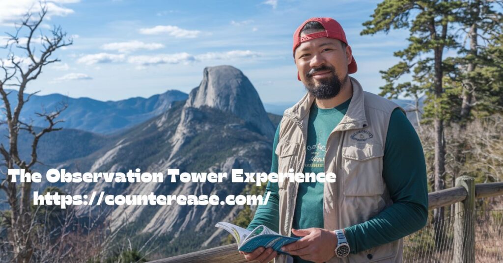
Tower design features:
- Circular observation platform with 360° views
- Graduated ramp that spirals upward rather than stairs
- Protected viewing area that shields visitors from frequent high winds
- Information panels identifying visible landmarks in all directions
Once at the top, orientation panels help visitors identify key features visible from each direction:
- North: Look for Mt. Le Conte, Gatlinburg (on clear days), and the Tennessee Valley beyond
- East: The Black Mountains of North Carolina (including Mt. Mitchell, the highest peak east of the Mississippi)
- South: The rugged Nantahala and Pisgah National Forests of North Carolina
- West: Tennessee’s Cumberland Plateau and the Great Valley
On exceptionally clear days (most common in fall and winter), visibility can extend up to 100 miles. However, even with limited visibility, the sensation of standing above the clouds offers a profound experience of high-elevation solitude.
Photography Tips for the Tower
Photography spots at Kuwohi require some techniques specific to high-elevation shooting:
- Early morning typically offers the clearest conditions before heat haze develops
- Polarizing filters help cut through atmospheric haze and enhance mountain layers
- Wide-angle lenses capture the expansive panorama
- Telephoto lenses help isolate distant peaks and valleys
- The observation tower itself makes for compelling foreground elements when shot from the approach trail
- Winter visits offer spectacular opportunities to capture rime ice formations on the surrounding trees
Beyond the Main Trail: Connected Hiking Opportunities
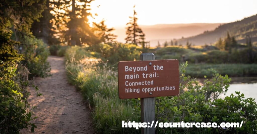
While many visitors come solely for the observation tower, Kuwohi serves as a hub for several significant trail intersections that offer extended hiking options:
Appalachian Trail Connections
The legendary Appalachian Trail crosses directly over Kuwohi, offering thru-hikers one of the highest points on their 2,190-mile journey. Day hikers can access this famous footpath via a short connector trail from the parking area.
Popular AT section hikes from Kuwohi include:
- Kuwohi to Newfound Gap (8.5 miles one-way, moderate difficulty)
- Kuwohi to Double Spring Gap Shelter (3.5 miles one-way, moderate difficulty)
- Kuwohi to Silers Bald (4.0 miles one-way, moderate difficulty)
Forney Ridge Trail
For those seeking a less-traveled experience, the Forney Ridge Trailhead begins near the parking area and leads to Andrews Bald (3.6 miles round-trip), an open grassy meadow famous for its spectacular flame azalea and rhododendron displays in June.
Case Study: A Three-Day Kuwohi Loop Experience
For backpackers seeking an immersive Smokies experience, this loop showcases the diversity of ecosystems surrounding Kuwohi:
First Day: Newfound Gap to Kuwohi via the Appalachian Trail (8.5 miles)
- Experience the high-elevation ridge traverse
- Camp at approved backcountry site near Double Spring Gap
Second Day : Kuwohi to Forney Creek via Forney Ridge Trail (8.7 miles)
- Descend from spruce-fir zone to lush hardwood forests
- Camp at approved backcountry site along Forney Creek
Third Day : Forney Creek to Newfound Gap via Forney Creek Trail and Clingmans Dome Road (10.2 miles)
- Experience the rich diversity of middle and lower elevation forests
- Complete the loop back to your starting point
This loop requires a backcountry permit from the National Park Service and showcases the remarkable ecological diversity within a relatively compact area.
Optimal Timing: Sunrise and Sunset Experiences
While Kuwohi is magnificent at any time of day, sunrise and sunset transform the landscape into something truly extraordinary. The interplay of golden light, mountain shadows, and often a dramatic undercast of clouds creates photography spots that rival any in North America.

Sunrise Tips
For sunrise visits:
- Arrive at the parking area at least 45 minutes before sunrise
- Bring a headlamp or flashlight for the dark trail walk
- Be prepared for significantly colder temperatures than daytime
- Consider bringing a thermos of hot coffee or tea
- Position yourself on the eastern side of the observation tower
- Watch for the dramatic moment when the sun first crests the distant Blue Ridge Mountains
Sunset Strategies
For sunset visits:
- Check sunset time and plan to stay at the tower until approximately 20-30 minutes after sunset for optimal colors
- Bring warm layers as temperatures drop quickly after sundown
- Carry a reliable light source for the return hike in darkness
- Consider bringing a lightweight camping chair for comfort while waiting
- Be aware that parking typically becomes more available in late afternoon
National park regulations require visitors to remain on developed trails after dark, so nighttime stargazing should be conducted from designated trails or viewing areas only.
Natural and Cultural Heritage
Cherokee Connection to Kuwohi
The Kuwohi name change represents an important recognition of the mountain’s significance to Cherokee people. “Kuwohi,” meaning “Mulberry Place” in Cherokee, connects to the Traditional Ecological Knowledge of the Eastern Band of Cherokee Indians. The cultural significance of this mountain to Cherokee people includes:
- Historical gathering site for medicinal plants
- Important landmark in traditional stories and oral histories
- Spiritual significance as one of the highest places in Cherokee ancestral territory
- Recognition of Mulberry Place as a site of traditional resources
The Eastern Band of Cherokee Indians advocated for years for this recognition, which finally occurred in 2023, adding important Cherokee heritage context to visitors’ understanding of this special place.
Environmental Conservation Challenges
The high-elevation ecosystem at Kuwohi faces significant conservation challenges:
- The balsam woolly adelgid, an invasive insect that has decimated Fraser fir populations
- Air pollution impacts on visibility and forest health
- Climate change pressures on this temperature-sensitive ecosystem
- Heavy visitor use impacting fragile soil and vegetation near the trail
The National Park Service actively manages these challenges through research, restoration efforts, and visitor education. By staying on designated trails and respecting closure areas, visitors contribute to environmental conservation of this unique place.
Visitor Etiquette and Conservation

The fragile nature of Kuwohi’s ecosystem requires special care from visitors. Following national park regulations and outdoor recreation best practices ensures this special place remains protected for future generations:
Leave No Trace principles for Kuwohi:
- Stay on the paved trail to protect sensitive vegetation
- Pack out all trash, including food scraps and tissues
- Respect wildlife by maintaining appropriate distance
- Keep noise levels down to avoid disturbing wildlife and other visitors
- Do not pick plants or remove any natural items
- Use restroom facilities before hitting the trail
Hiking preparedness essentials for a safe visit:
- Water (at least 16 oz per person for this short but strenuous hike)
- Weather-appropriate clothing, including rain gear
- Sun protection
- Map and compass or GPS backup
- Flashlight or headlamp if staying for sunset
- Basic first aid supplies
See Also: Hiking Knife’s Edge & Bear Rocks on the Appalachian Trail, PA
Practical Tips From Experienced Visitors
After talking with park rangers and frequent visitors, I’ve compiled these insider tips for maximizing your Kuwohi experience:
- Visit on weekdays whenever possible to avoid the most intense crowds
- If you must visit on weekends, aim for early morning (before 9 am) or later afternoon (after 3 pm)
- Consider hiking up Kuwohi Road when it’s closed to vehicles in winter for a uniquely peaceful experience
- The clearest views typically occur after cold fronts pass through, especially in fall and winter
- Spring brings beautiful wildflowers to the forest floor along the trail
- Look for the rare northern flying squirrel at dusk (requires patience and sharp eyes)
- The best fall foliage views typically occur in mid-October
- During summer, afternoon thunderstorms often develop—plan morning visits during this season
Children-friendly activities to enhance their experience:
- National Park Junior Ranger program (booklets available at visitor centers)
- “I Spy” games identifying different tree species along the trail
- Cloud-watching from the observation tower
- Wildlife tracking and birding
Seasonal Variations Worth Experiencing
Each season transforms Kuwohi in distinctive ways, offering completely different experiences throughout the year:
Spring (April-May):
- Emerging green forest waking from winter
- Dancing mists and frequent rainbows
- Wildflowers blooming along the forest floor
- High water flow in streams visible from the tower
- Better chance of solitude than summer months
Summer (June-August):
- Lush, full forest canopy
- Afternoon cloud formations and potential thunderstorms
- Cooler temperatures than surrounding lowlands (a welcome relief)
- Greatest biodiversity of birds and wildlife
- Most facilities and services available
Fall (September-November):
- Spectacular foliage transformations
- Clearer atmospheric conditions for long-range views
- Vivid sunrise and sunset experiences
- Pleasant hiking temperatures
- Highest visitor numbers, especially October weekends
Winter (December-March):
- Road closure creates a wilderness-like experience
- Dramatic snow and ice formations
- Stillness and solitude rare in popular parks
- Crystal-clear visibility on fair days
- Challenges requiring proper preparation and equipment
Whether you’re seeking the electric colors of fall, the mystical mists of spring, the dramatic storms of summer, or the pristine solitude of winter, Kuwohi offers a completely different experience with each visit.
Frequently Asked Questions
1.How long does it take to hike to the observation tower?
Most visitors complete the half-mile trail in 30-45 minutes going up and 15-30 minutes coming down.
2.When is the best time for clear views?
The clearest views typically occur on cool, dry days after the passage of a cold front.
3.Is Kuwohi Road open year-round?
No, the road typically closes from December 1 through March 31 due to ice and snow.
4.Are pets allowed on the trail?
Yes, leashed pets are permitted on the paved trail to the observation tower. Pets must be on a leash no longer than 6 feet at all times.
5.Can I see both sunrise and sunset in one day?
Yes! During shorter winter days, the time between sunrise and sunset is brief enough that ambitious visitors can experience both in a single day.
Conclusion
The kuwohi-clingmans-dome-trail is a journey filled with beauty and adventure. Its steep but rewarding path leads to breathtaking mountain views that stretch for miles. Every step through the cool spruce-fir forest brings a sense of peace and connection with nature. The observation tower at the summit offers a stunning panorama, making the effort truly worthwhile.
Hiking the kuwohi-clingmans-dome-trail is an experience that stays with you. The changing seasons add unique charm, from summer’s green canopy to autumn’s fiery colors. Whether visiting for a short walk or a full hike, this trail promises unforgettable moments. Its blend of history, natural beauty, and fresh mountain air makes it a must-visit in the Smoky Mountains.
Standing atop Kuwohi connects visitors to something larger than themselves—a view spanning centuries, an ecosystem in delicate balance, and a peak significant to both indigenous and modern cultures. By understanding and respecting this special place, you’ll not only have a more meaningful visit but help ensure its preservation for generations to come
Have you visited Kuwohi/Clingmans Dome? What season did you experience, and what were your favorite discoveries? Share your stories in the comments below!

Asia Jenni is a passionate travel writer and expert author on CounterEase.com. With a deep love for exploration, she shares insightful travel guides, tips, and destination recommendations, helping travelers discover new places with ease. Her expertise in curating memorable trips and her engaging writing style make her a valuable resource for anyone looking to plan their next adventure.