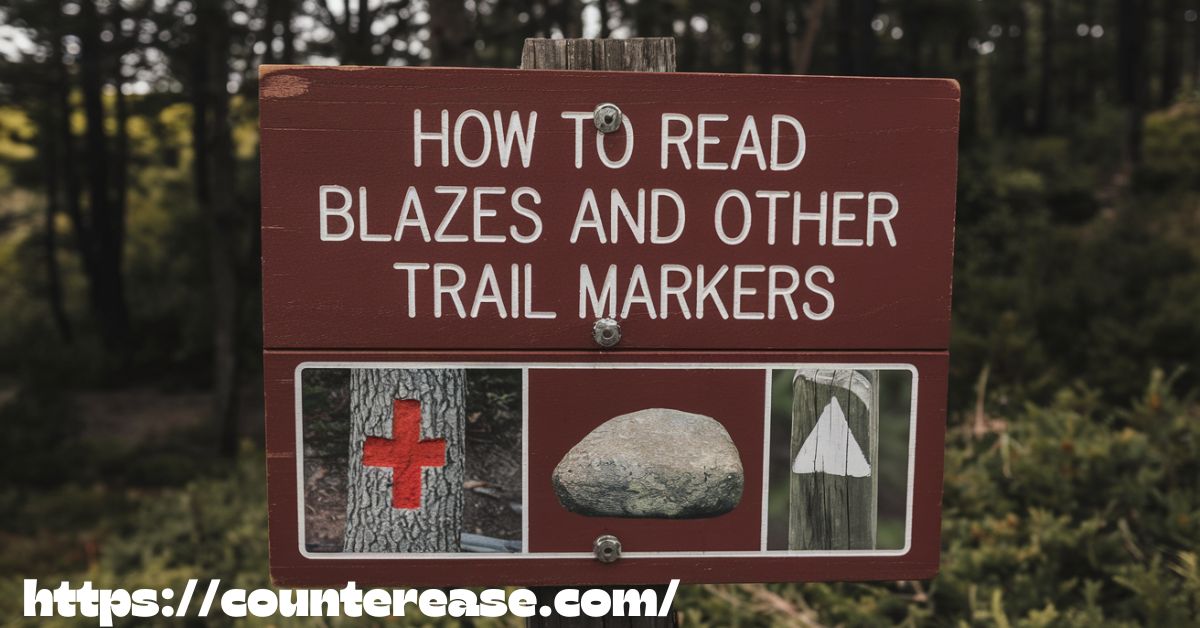
How to read blazes and other trail markers is a fundamental skill for safe and successful hiking. Trail markers, including painted blazes, cairns, affixed signs, and colored flags, guide hikers through various terrains, ensuring they stay on the right path. Each symbol carries specific meaning, from indicating a turn to marking intersections or potential hazards. Understanding these markers enhances navigation skills, reduces the risk of getting lost, and allows for a more enjoyable outdoor experience.
Navigating the wilderness feels like unlocking a secret code left by experienced trailblazers. A single misplaced step can lead to confusion, but knowing how to interpret blazes keeps hikers confident and on track. Whether following a well-worn path or venturing into lesser-traveled routes, recognizing trail markers adds an extra layer of safety and adventure, making each journey smoother and more rewarding.
Mastering how to read blazes and other trail markers transforms an ordinary hike into a well-guided exploration. Different trails use unique marking systems, and learning their meanings helps hikers travel efficiently while respecting nature’s balance. From simple color-coded blazes to stacked rock formations, each sign serves a purpose. By understanding these essential markers, outdoor enthusiasts can confidently embark on new trails without fear of losing their way.
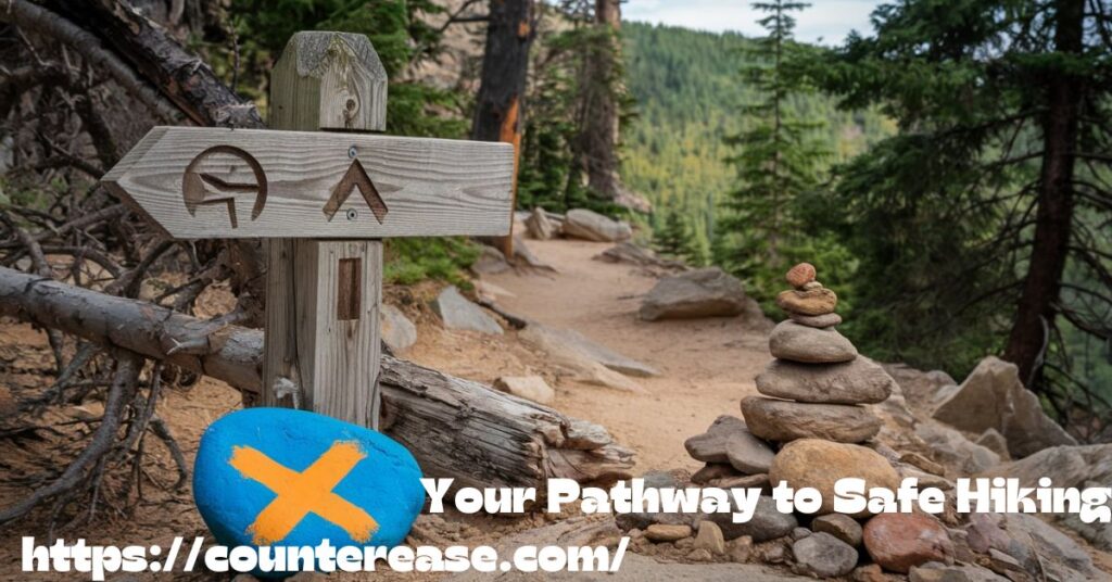
Your Pathway to Safe Hiking
Imagine stepping onto a hiking trail, surrounded by wilderness, with nothing but your wits and the subtle markings guiding your journey. Trail blazes are more than just colorful paint splatters or random signs—they’re your lifeline in the great outdoors. Understanding these navigational aids can mean the difference between a memorable adventure and a potentially dangerous misadventure.
The Science and Art of Trail Navigation
Trail navigation is a unique blend of scientific precision and intuitive understanding. It’s a skill that has evolved over centuries, from indigenous wayfinding techniques to modern GPS-assisted hiking. Trail markers serve as a critical communication system in the wilderness, providing hikers with essential information about direction, difficulty, and potential hazards.
See Also: Five Easy Trails in Red River Gorge
Why Trail Marker Knowledge Matters
Hiking isn’t just about walking; it’s about navigation, safety, and respect for the environment. Trail navigation skills are crucial for:
- Preventing getting lost
- Ensuring personal safety
- Protecting fragile ecosystem boundaries
- Maintaining trail integrity
- Enhancing overall hiking experience
- Developing a deeper connection with nature
Historical Context of Trail Marking
Evolution of Trail Marking Systems
Trail marking has a rich history dating back to ancient civilizations:
Indigenous Wayfinding
- Native American groups used natural markers
- Inuit people developed complex snow and ice navigation techniques
- Aboriginal Australians created intricate land navigation systems
Modern Trail Marking Development
- 19th-century hiking clubs began standardizing trail markers
- Appalachian Trail pioneered consistent blaze marking in 1937
- National parks developed comprehensive marker systems
Types of Trail Markers: A Comprehensive Exploration
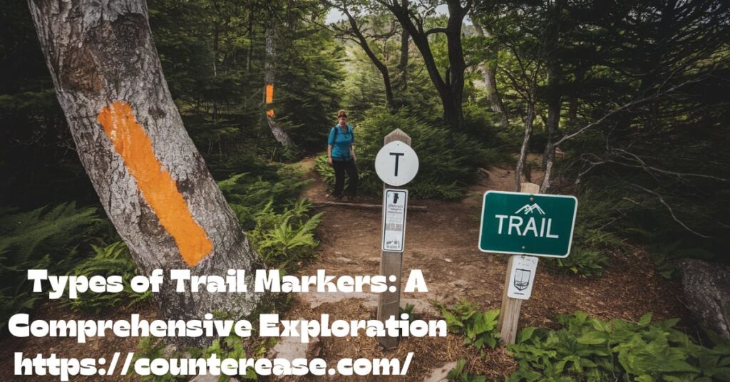
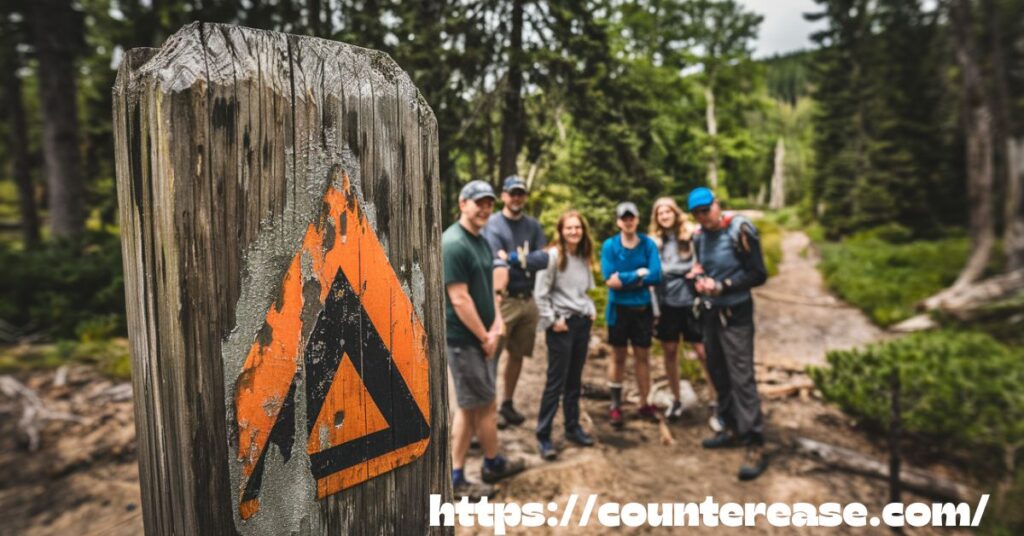
Painted Blazes: The Hiker’s Primary Language
Painted blazes are the most common trail markers, typically found on trees, rocks, and trailside structures. These colorful indicators communicate critical information about your route.
Blaze Color Coding: What They Really Mean
| Color | Typical Meaning | Common Use | Psychological Impact |
|---|---|---|---|
| White | Main/Primary Trail | Appalachian Trail | Clarity and Openness |
| Blue | Secondary Trail | State Park Connectors | Calm and Direction |
| Red | Challenging/Difficult Route | Mountain Trails | Caution and Intensity |
| Yellow | Easy/Beginner Trail | Nature Walks | Optimism and Accessibility |
| Green | Interpretive/Educational Trail | National Parks | Nature and Harmony |
| Orange | Hunting Trails | Wildlife Areas | Warning and Visibility |
Blaze Shape and Direction Interpretation
- Single Blaze: Straight path ahead
- Double Blaze: Upcoming turn or trail junction
- Offset Blazes: Indicates specific turning direction
- Angled Blazes: Shows precise turn angle
Physical Trail Markers Beyond Paint
Affixed markers and alternative indicators provide additional navigation support:
Trail Signs and Posts
- Wooden directional signs
- Metal trail number markers
- Distance and difficulty indicators
- GPS coordinate references
International Trail Marker Comparison
| Country | Primary Marker Type | Unique Characteristics |
|---|---|---|
| USA | Painted Blazes | Color-coded system |
| Switzerland | Numbered Trail Signs | Precise distance markers |
| New Zealand | Pole Markers | Reflective for night hiking |
| Germany | Color-Coded Symbols | Detailed difficulty ratings |
| Canada | Cairns and Paint Markers | Wilderness-adapted system |
Cairns: Stone Navigation Markers
- Carefully stacked rock formations
- Common in alpine and desert environments
- Marks trail when vegetation is sparse
- Requires careful interpretation
Trail Ribbons and Flagging
- Temporary trail marking method
- Used during trail maintenance
- Color-coded for specific purposes
- Should be removed after use
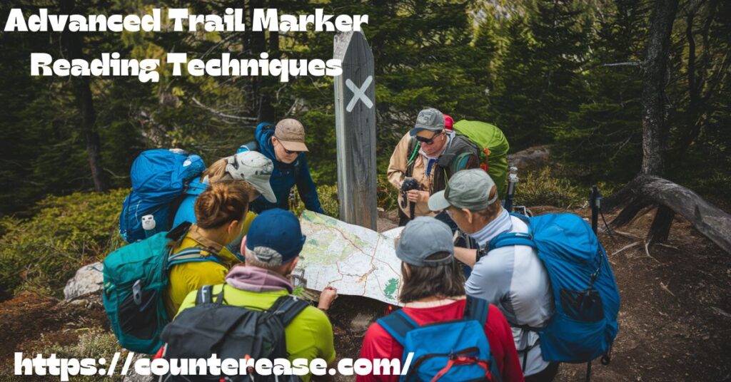
Advanced Trail Marker Reading Techniques
Advanced trail marker reading techniques go beyond basic blaze recognition, helping hikers interpret subtle signs, unmarked routes, and complex navigation systems. These skills are crucial for backcountry hiking, long-distance trekking, and off-trail exploration.
One key technique is understanding multi-blaze patterns, where stacked or angled blazes indicate upcoming turns, intersections, or changes in terrain. Some trails use carved symbols, rock cairns, or etched markers to guide hikers through rugged landscapes. In winter conditions, tree scars and snow markers become vital, as traditional blazes may be hidden under snow.
Hikers should also recognize historical or unofficial markers, such as bent trees, stacked branches, or old survey markers, which may indicate paths used by early explorers or indigenous travelers. Combining these advanced reading skills with GPS and topographic maps ensures safe and efficient navigation, even in the most remote or unpredictable environments.
Decoding Complex Trail Junctions
Navigating trail intersections requires keen observation and understanding of marker placement:
- Look for multiple blazes or signs
- Check directional arrows
- Observe blaze colors and patterns
- Consult any available trail maps
- When in doubt, stop and assess
Advanced Navigation Tools Comparison
| Tool | Pros | Cons | Best Use |
|---|---|---|---|
| Physical Map | No battery needed | Limited real-time updates | Backup navigation |
| GPS Device | Precise location | Battery dependent | Wilderness tracking |
| Smartphone App | Multiple features | Signal limitations | Supplementary navigation |
| Compass | Always works | Requires skill | Basic orientation |
| Altimeter | Elevation tracking | Limited directional info | Mountain trails |
Safety Strategies for Trail Navigation
Preventing Navigational Errors
- Pre-Hike Preparation
- Research trail markings
- Download digital trail maps
- Check local ranger station for updates
- Understand regional marking conventions
- Essential Navigation Tools
- Physical map and compass
- GPS device
- Smartphone with offline maps
- Backup battery pack
- Emergency signaling device
Environmental Considerations
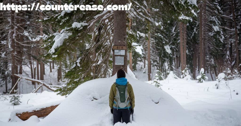
Trail Marker Variations by Terrain
- Mountain Trails: Often use rock cairns and painted blazes
- Desert Environments: Rely more on cairns and metal signs
- Forest Trails: Predominantly painted blazes on trees
- Urban Trail Systems: Combination of painted markers and street signage
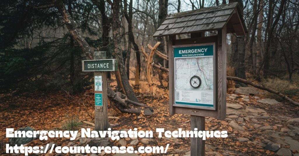
Emergency Navigation Techniques
When technology fails or trail markers disappear, emergency navigation techniques become essential for survival. These methods help hikers find their way using natural clues and traditional skills when lost or disoriented.
Key techniques include terrain association, where hikers match their surroundings with a mental map of the area. Triangulation with a compass helps pinpoint a location using known landmarks. In open landscapes, using the sun as a directional guide—where it rises in the east and sets in the west—can aid orientation. At night, the North Star provides a steady reference for north in the Northern Hemisphere.
Other survival techniques include following water sources, as streams often lead to roads or settlements, and observing wind patterns that may indicate weather changes. When lost, staying in one place and making signals (such as stacking rocks or using reflective objects) increases the chances of being found by rescuers.
What to Do When Markers Disappear
If you find yourself uncertain of the trail:
- Stop and remain calm
- Use your last known marker as a reference
- Check GPS or digital map
- Look for natural landmarks
- Consider backtracking to the last clear marker
- Use sun position for basic orientation
- Listen for water sources or human activity
“In the wilderness, your ability to read the landscape is more important than any single marker.” – Anonymous Wilderness Guide
Advanced Topics in Trail Navigation
Trail navigation goes beyond following basic blazes and markers. Advanced techniques help hikers navigate challenging terrains, unmarked trails, and unpredictable conditions. Understanding topographic maps, GPS navigation, and natural landmarks enhances outdoor safety and confidence. Features like contour lines, elevation markers, and compass readings provide crucial insights when trails become unclear.
In remote areas or off-trail adventures, hikers rely on triangulation, sun positioning, and terrain association to stay on course. Knowledge of emergency navigation, such as recognizing key landforms or using the stars for direction, can be life-saving. Combining traditional and modern navigation skills ensures a smooth and secure journey in any wilderness setting.
Psychological Aspects of Wayfinding
- Understanding spatial awareness
- Developing intuitive navigation skills
- Managing navigation-related anxiety
- Building confidence through practice
Technology and Traditional Navigation
The future of trail navigation lies in the integration of traditional marker systems with cutting-edge technology:
- Augmented reality trail guides
- AI-powered navigation assistants
- Crowdsourced trail marker updates
- Satellite-assisted precision tracking
Becoming a Trail Marker Expert
Trail navigation is an art and science. By understanding blazes, trail signs, and marker systems, you transform from a casual hiker to a confident explorer.
Recommended Learning Resources
- Books:
- “Navigation Techniques for Hikers”
- “Reading the Trail: Exploring Marker Systems”
- “Wilderness Survival Guide”
- Online Courses:
- Wilderness Navigation Workshops
- REI Outdoor Skills Programs
- Mountaineering Navigation Certifications
- Mobile Apps:
- AllTrails
- Gaia GPS
- ViewRanger
- Komoot
Remember, every trail has a story, and its markers are the words that tell that tale. Learn to read them, and the wilderness will always guide you home.
Stay safe, stay curious, and happy hiking!
See Also: Kuwohi Clingmans Dome Trail Guide in the Smoky Mountains
FAQs
1. What do different blaze colors mean on a trail?
Blaze colors vary by trail system, but generally, white marks long-distance trails, blue indicates side trails, and yellow or red marks regional trails.
2. How do double blazes on a trail help hikers?
Two stacked blazes usually signal a turn, with the top blaze leaning in the direction of the turn. It can also indicate a change in trail conditions.
3. Are cairns considered official trail markers?
Yes, cairns (stacked rocks) are used in rocky or open areas where painted blazes aren’t practical, but hikers should never add or remove them.
4. What should I do if I lose the trail markers?
Stop, retrace your steps to the last visible marker, and look for signs of the correct path. void wandering off-trail, as this can lead to getting lost.
5. Do all trails follow the same blaze system?
No, blaze colors and symbols vary by region and park. Checking the official trail guide or park website before hiking ensures accurate navigation.
Conclusion
Knowing how-to-read-blazes-and-other-trail-markers makes hiking safer and more enjoyable. These markers guide you through forests, mountains, and winding trails. Understanding colors, shapes, and symbols helps you stay on the right path. Whether following painted blazes, cairns, or trail signs, each marker has a purpose. Learning them prevents confusion and keeps your adventure stress-free.
Every trail has its own marking system, so recognizing these signs is important. How-to-read-blazes-and-other-trail-markers is a skill every hiker should have. It boosts confidence and allows you to explore new places without worry. A well-marked trail leads to breathtaking views and unforgettable experiences. By paying attention to these markers, you can hike with ease and fully enjoy nature’s beauty.

Asia Jenni is a passionate travel writer and expert author on CounterEase.com. With a deep love for exploration, she shares insightful travel guides, tips, and destination recommendations, helping travelers discover new places with ease. Her expertise in curating memorable trips and her engaging writing style make her a valuable resource for anyone looking to plan their next adventure.