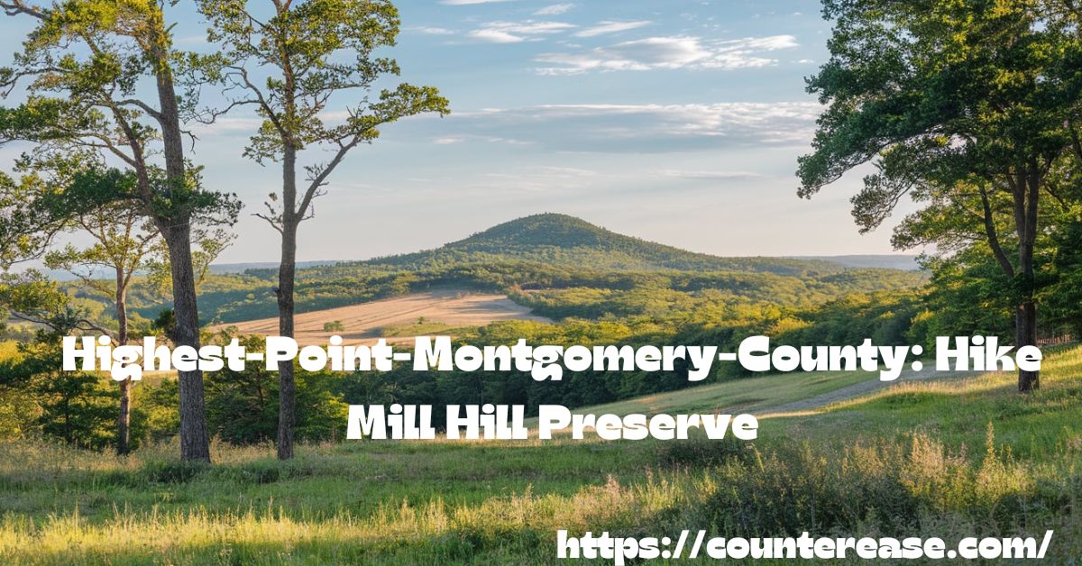
The highest point in Montgomery County is a scenic, elevated spot offering breathtaking views and a rewarding hiking experience. Nestled within the Mill Hill Preservation Area, this peak stands as a hidden gem for outdoor enthusiasts seeking a mix of challenge and tranquility. With several miles of trails winding through dense forests and rocky terrain, it provides an immersive escape into nature, making it a must-visit for hikers of all skill levels.
Few places combine accessibility and adventure as perfectly as Mill Hill Preserve. The trails here take you through oak-lined forests, rocky paths, and gentle slopes, leading to the highest point in Montgomery County. Whether you’re trekking on a beautiful fall day or enjoying a quick morning hike, this journey promises both challenge and reward. The views from the summit, particularly at sunrise or sunset, make every step worthwhile.
Reaching the highest point in Montgomery County is more than just a hike—it’s an experience. The well-marked loop trail, featuring steep and rocky trails alongside flat and easy trails, offers something for everyone. Along the way, you’ll encounter Hosensack Creek, unique rock formations, and a variety of wildlife, making it a fulfilling adventure for nature lovers. With proper preparation and respect for the environment, this hike guarantees an unforgettable journey into the heart of Montgomery County’s natural beauty.
Preparing for Your Hike
Before hitting the trailhead, it’s important to prepare. The Mill Hill Preservation Area offers several miles of trails, ranging from flat and easy trails to rocky and challenging trails. Here’s what you need to know before heading out.

Parking & Access
| Feature | Details |
|---|---|
| Location | Mill Hill Preservation Area, Montgomery County, PA |
| Parking Area | Available at the main entrance |
| Capacity | Limited, so arrive early on weekends |
| Facilities | No bathrooms in the parking area |
| Nearest Store | Walmart nearby for last-minute supplies |
Tip: The park can get busy on weekends, so visiting early in the morning or on weekdays ensures a quieter experience.
Trail Map & Navigation
The trails are clearly marked, but downloading a trail map beforehand is recommended. Look for:
- Red trail markers marking the steep and rocky trail
- Stone pillar with red blaze at the beginning of the Red Trail
- Loop trail that starts and ends on the Orange Trail
Bringing a printed or digital trail map will help avoid confusion at intersections. The trails are well maintained, thanks to trail maintenance efforts, including an Eagle Scout Project that improved bridge crossings and signage.
See Also: Kuwohi Clingmans Dome Trail Guide in the Smoky Mountains
Weather & Safety Tips
- Best time to visit: A beautiful fall day offers stunning fall foliage views.
- Hunting season: Hunting allowed in the area, so wear bright orange attire for safety.
- Trail conditions: Some sections are steep and rocky, so wear sturdy hiking boots.
- Wildlife: Be on the lookout for local wildlife, including deer, wild turkeys, and birds of prey.
- Hydration: Bring at least 1-2 liters of water per person.
- Bug protection: Mosquitoes and ticks are common in warmer months, so apply insect repellent.
- Cell service: Limited in certain areas, so download maps and let someone know your hiking plan.
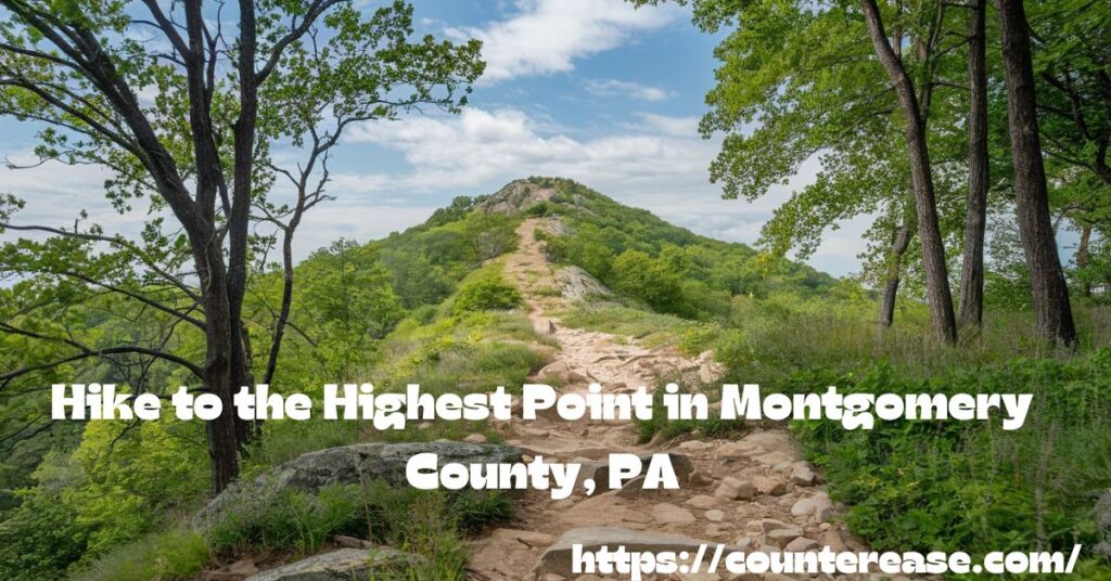
Hike to the Highest Point in Montgomery County, PA
Reaching the highest point in Montgomery County, PA, at Mill Hill Preservation Area, offers a rewarding challenge for hikers of all skill levels. The well-maintained trails, scenic views, and diverse terrain make this a must-visit destination for nature enthusiasts. Whether you take the Red Trail for a direct yet challenging ascent or the Orange Trail for a longer, more gradual climb, the experience is equally rewarding.
Trailhead
The trailhead is located at the north side of the parking lot. Hikers will find clearly marked paths, with red and orange trail markers guiding the way. The starting point is easy to locate, with a stone pillar featuring a red blaze marking the entrance to the Red Trail.
| Feature | Details |
|---|---|
| Location | North side of the parking lot at Mill Hill Preservation Area |
| Trail Options | Red Trail (steeper, direct) & Orange Trail (longer, moderate) |
| Signage | Clearly marked trail signs and blaze markers |
| Best Time to Start | Early morning for cooler temperatures and fewer crowds |
| Facilities | No restrooms at the trailhead; nearest facilities at Walmart nearby |
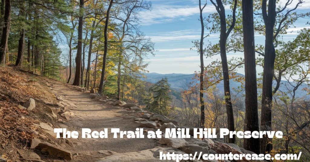
The Red Trail at Mill Hill Preserve
For those looking for a more direct yet steep ascent, the Red Trail is the best option. This rocky and challenging trail winds through a dense forest, featuring a moderate elevation gain before reaching the summit.
| Feature | Details |
|---|---|
| Distance | Approx. 2.5 miles (loop trail) |
| Elevation Gain | Moderate, with steep inclines |
| Trail Difficulty | Moderate to difficult due to rocky terrain |
| Scenery | Forested areas, rock formations, wildlife |
| Key Markers | Red Trail markers, stone pillar at entry |
Hikers should be prepared for uneven terrain and bring sturdy footwear. This trail offers quick access to the highest point in Montgomery County, but the incline requires good endurance.
Overlook and Highest Point
The overlook at the highest point in Montgomery County provides breathtaking views of the rolling hills and dense forests. On clear days, hikers can see miles of untouched natural beauty. The area is peaceful, making it a great spot to rest, take photos, and appreciate the scenery.

| Feature | Details |
|---|---|
| Elevation | Highest point in Montgomery County |
| View | Panoramic landscape, forests, and wildlife |
| Best Time to Visit | Fall for vibrant foliage; early mornings for solitude |
| Wildlife | Deer, hawks, songbirds, and occasional fox sightings |
Many hikers consider this the most rewarding part of the hike. It’s an excellent place to pause, rehydrate, and enjoy nature before descending.
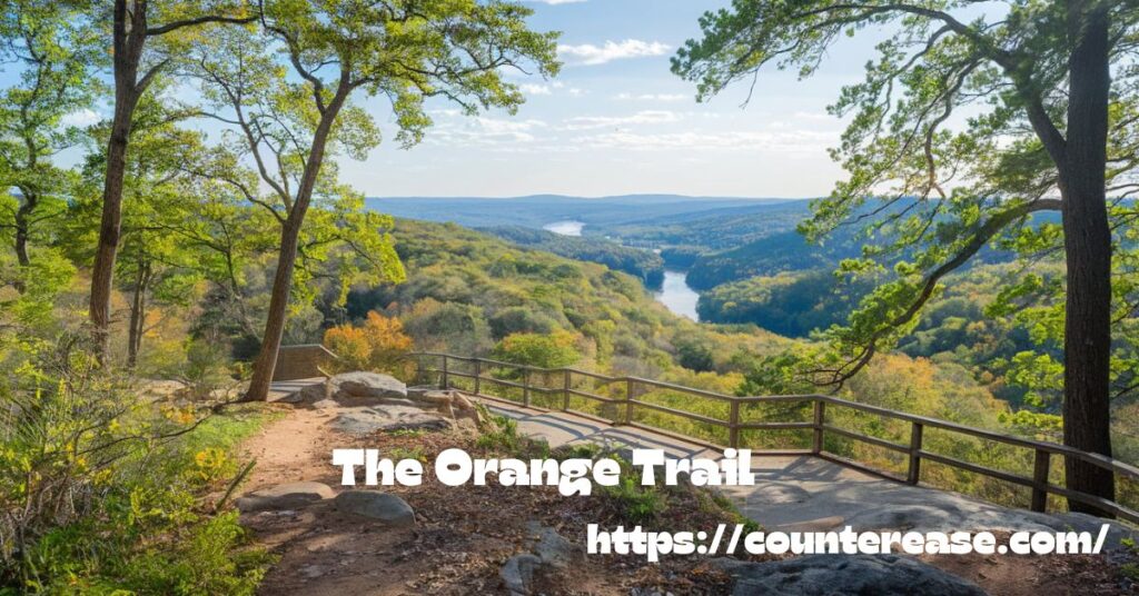
The Orange Trail
For those looking for a less steep but longer hike, the Orange Trail provides an alternative route. This loop trail is easier on the legs and passes through diverse terrain, including wooded areas, creek crossings, and scenic overlooks.
| Feature | Details |
|---|---|
| Distance | 3 miles (loop trail) |
| Trail Difficulty | Easy to moderate |
| Scenery | Mix of dense forest, open fields, and rocky sections |
| Wildlife | Birdwatching hotspots, small mammals, and seasonal wildflowers |
| Notable Feature | Includes an Eagle Scout Project bridge |
The Orange Trail is perfect for those who want to spend more time in the woods and experience a less demanding hike while still reaching the highest point in Montgomery County.
What to Expect Along the Trail
Hiking at Mill Hill Preservation Area offers a mix of scenic landscapes, diverse wildlife, and well-marked hiking trails. The trails take you through wooded areas, rocky paths, and scenic overlooks, making for an exciting outdoor adventure.

Flora & Fauna
Expect to see a variety of trees, plants, and wildlife along the trails.
- Trees: Towering oak, maple, and birch trees create a shaded path, especially vibrant in the fall.
- Wildlife: Look out for deer, wild turkeys, chipmunks, squirrels, and hawks soaring above.
- Birdwatching: Warblers, woodpeckers, and other native birds make the area a birdwatcher’s paradise.
See Also: Hike to an Overlook and Waterfall at Monocacy Hill Recreation Area
Trail Conditions
| Feature | Details |
|---|---|
| Trail Type | Loop trail, starting and ending on Orange Trail |
| Difficulty | Varies from flat and easy trails to rocky and challenging trails |
| Elevation Gain | Moderate, with steep sections on the Red Trail |
| Best Seasons | Spring and fall for mild temperatures and scenic views |
| Safety Tips | Wear sturdy hiking boots and carry a trail map |
Weather & Seasonal Changes
- Spring: Lush greenery and mild temperatures make it an ideal season for hiking.
- Summer: Can be hot and humid with increased mosquito activity.
- Fall: The fall foliage offers breathtaking colors, making it one of the best times to visit.
- Winter: Snow may cover the trails, so proper winter gear and caution are necessary.
By knowing what to expect along the Mill Hill Preservation Area trails, you can plan a safe and enjoyable hike to the highest-point-montgomery-county.
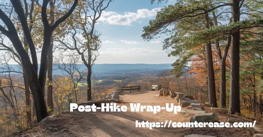
Post-Hike Wrap-Up
Nearby Attractions
| Attraction | Distance from Mill Hill |
|---|---|
| Perkiomen Trail | 10 miles |
| Evansburg State Park | 15 miles |
| Valley Forge National Park | 20 miles |
FAQs
1. How high is the highest point in Montgomery County, PA?
The highest-point-montgomery-county at Mill Hill Preservation Area is approximately 840 feet above sea level.
2. How long does it take to hike to the highest point?
It takes about 1.5 to 2.5 hours to complete the loop, depending on your pace and trail choice.
3. Are there any facilities like restrooms or water fountains?
No, there are no bathrooms or water fountains at the trailhead, but a porta-john is available along the Orange Trail.
4. Is the hike suitable for beginners?
Yes, but the Red Trail is steep and rocky, while the Orange Trail is an easier route for beginners.
5.Is hunting allowed in Mill Hill Preservation Area?
Yes, hunting is allowed, so wear bright orange attire during hunting season for safety.
See Also: 5 Beautiful Waterfalls in Mercer County, West Virginia
Conclusion
The highest-point-montgomery-county at Mill Hill Preservation Area offers a rewarding hike with stunning views. The Red Trail takes you through rocky paths, while the Orange Trail provides a gentler route. Both trails lead to a peaceful overlook where you can enjoy nature at its best. Whether you’re here for a quick morning hike or a longer adventure, this nature preserve has something for everyone.
Visiting the highest-point-montgomery-county is a great way to connect with nature and take in the beauty of Montgomery County, PA. The well-marked trails, scenic forests, and diverse wildlife make every hike enjoyable. Just remember to follow Leave No Trace principles, wear proper hiking gear, and stay on the trails. With its mix of easy and challenging paths, Mill Hill is the perfect place for hikers of all levels.

Asia Jenni is a passionate travel writer and expert author on CounterEase.com. With a deep love for exploration, she shares insightful travel guides, tips, and destination recommendations, helping travelers discover new places with ease. Her expertise in curating memorable trips and her engaging writing style make her a valuable resource for anyone looking to plan their next adventure.