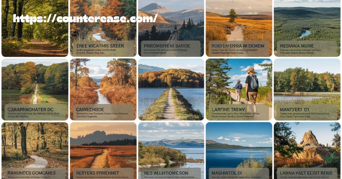
The best hikes near Washington, DC offer a perfect mix of scenic beauty, challenging trails, and peaceful nature escapes. Just outside the bustling city, these trails wind through lush forests, rocky overlooks, and historic landscapes. Whether you’re looking for a short, family-friendly stroll or a demanding trek with breathtaking views, the DC area has plenty of options. From the iconic Billy Goat Trail along the Potomac River to the panoramic summit of Old Rag, every hike brings a unique experience for outdoor lovers.
Imagine standing atop a rugged cliff, feeling the cool breeze as you take in the stunning view of rolling hills and winding rivers. The hikes near DC aren’t just trails; they’re adventures waiting to be explored. Towering waterfalls, wildflower-filled meadows, and peaceful woodland paths make each step an unforgettable experience. These trails provide the perfect escape from the city’s noise and reconnect you with nature’s beauty.
With so many incredible trails, the best hikes near Washington, DC offer something for everyone. Whether you prefer a quick morning hike at Great Falls or an all-day adventure in Shenandoah National Park, the options are endless. Each trail showcases the region’s diverse landscapes, making it a top destination for hikers of all skill levels. Grab your gear and hit the trails—your next outdoor adventure starts here!
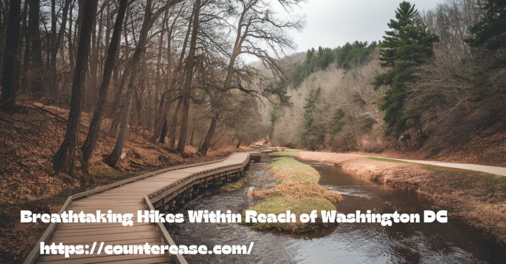
Breathtaking Hikes Within Reach of Washington DC
Living in or visiting the nation’s capital doesn’t mean you’re limited to monuments and museums. Within a short drive from DC’s urban core lies an impressive array of hiking trails that showcase the Mid-Atlantic’s diverse landscapes. From rocky river corridors to mountain summits with panoramic views, the best hikes near Washington DC offer something for every outdoor enthusiast.
I’ve spent years exploring these trails, and I’m excited to share my insider knowledge of the 17 most rewarding hiking spots near DC – complete with practical tips you won’t find in standard guidebooks. Whether you’re looking for a quick nature escape during lunch or planning a full-day adventure, this guide has you covered.
Understanding the DC Region’s Hiking Terrain
Before diving into specific trails, let’s get oriented with what makes the DC area unique for hikers.
The Washington region sits at the intersection of several distinct ecosystems. To the west, the Blue Ridge Mountains and Appalachian range offer challenging elevation and spectacular vistas. To the east, the Potomac River has carved dramatic gorges and falls. This geographical diversity means you can experience everything from gentle riverside walks to challenging mountain summits, all within a 2-hour drive of downtown.
“The DC area offers one of the most accessible and varied hiking experiences of any major urban center in America. Where else can you scramble over billion-year-old rocks in the morning and be back for a dinner reservation on Pennsylvania Avenue?” – Potomac Appalachian Trail Club Guide
The region experiences four distinct seasons, each offering a different hiking experience:
| Season | Trail Conditions | Special Features | Crowd Levels |
|---|---|---|---|
| Spring | Often muddy, especially April | Spectacular wildflowers, waterfalls at peak flow | Moderate |
| Summer | Hot, humid, occasional thunderstorms | Dense tree canopy provides shade, swimming holes | High |
| Fall | Dry, comfortable temperatures | Peak foliage (mid-Oct to early Nov), clear vistas | Very High |
| Winter | Variable, potential ice/snow | Leafless trees offer extended views, solitude | Low |
Understanding these patterns will help you choose the perfect hike for your timeframe and preferences.
See Also: How to Read Blazes and Other Trail Markers
Preparing for Your DC Area Hiking Adventure
The variable terrain around DC requires thoughtful preparation. Here’s what experienced local hikers always bring:
- Water: At least 2L per person for summer hikes (more for strenuous trails like Old Rag)
- Proper footwear: Sturdy hiking boots for rocky trails (essential for Billy Goat Trail)
- Navigation: Cell service is spotty in many areas; bring downloaded maps
- Sun protection: Many overlooks have full exposure
- Bug repellent: Ticks are common May-September
Trail Difficulty Scale Used in This Guide:
- Easy: Minimal elevation gain (<300 ft), well-maintained surfaces, suitable for most fitness levels
- Moderate: Some elevation gain (300-1000 ft), potentially rocky sections, requires basic fitness
- Challenging: Significant elevation gain (>1000 ft), technical sections, requires good fitness
- Difficult: Strenuous climbing, rock scrambling, extended length, requires excellent fitness
Leave No Trace: Responsible Hiking in the Capital Region
With millions of visitors each year, the popular hiking trails Washington DC area offers face significant environmental pressure. Following Leave No Trace principles is essential:
- Plan ahead and prepare (check park websites for closures)
- Stick to established trails (particularly important in fragile riverside ecosystems)
- Pack out all trash (including food scraps and tissues)
- Leave natural objects undisturbed
- Respect wildlife (particularly important during spring when many animals are raising young)
- Be considerate of other visitors
Case Study: Great Falls Restoration After years of off-trail hiking damaged vegetation at Great Falls Park, the National Park Service implemented a trail restoration project in 2018. By staying on marked trails, visitors have helped native plants return to previously damaged areas, demonstrating how responsible hiking makes a difference.
Potomac River Valley Treasures
Billy Goat Trail at C&O Canal National Historical Park
The Billy Goat Trail stands as DC’s most iconic hike, offering dramatic Potomac River views and challenging terrain surprisingly close to the city. This trail system includes three distinct sections (A, B, and C), each with different difficulty levels.
What makes it special:
- Spectacular views of Mather Gorge’s 50-foot cliffs
- Class 3 rock scrambling on Section A (the most popular and challenging section)
- Unique geological features including massive river-polished boulders
- Rich diversity of plant life, including rare Potomac Gorge species
Quick facts:
- Trail length: Section A (1.7 miles), B (1.4 miles), C (1.6 miles)
- Difficulty: Section A (Difficult), B (Moderate), C (Easy)
- Elevation gain: Section A (200 feet)
- Parking: Great Falls Visitor Center ($20 entrance fee, often fills by 10am on weekends)
- Best time to visit: Weekday mornings or winter weekends to avoid crowds
Insider tip: Don’t attempt Section A after rain or during high water. The Park Service closes the trail during flood conditions, but even damp rocks can be treacherously slippery.
Northern Peaks Trail at Sugarloaf Mountain
Sugarloaf Mountain offers the closest true mountain experience to DC, rising 800 feet above the surrounding Maryland countryside. The Northern Peaks Trail combines multiple trail segments to create a loop showcasing the mountain’s best features.
Why you’ll love it:
- 360-degree views extending to the Blue Ridge Mountains
- Varied terrain from gentle woodland paths to moderate rock scrambles
- Fascinating Civil War history (used as a signal station during the conflict)
- Privately owned but open to the public thanks to conservation efforts
Quick facts:
- Trail length: 5.8-mile loop
- Difficulty: Moderate
- Elevation gain: 1,265 feet
- Parking: Free at East View or West View parking areas
- Best time to visit: Weekday mornings or off-season weekends
Insider tip: The mountain’s unusual microclimate supports plant communities typically found much further north. Look for the northern hackberry trees and walking fern, species rarely seen this far south.
Maryland Heights and Western Maryland Gems
Maryland Heights Trail
The Maryland Heights Trail offers perhaps the most historically significant hike in the region, with Civil War artillery positions and the most photographed view of Harpers Ferry.
What you’ll experience:
- Sweeping views of the confluence of the Potomac and Shenandoah Rivers
- Well-preserved Civil War fortifications
- Challenging elevation gain rewarded with spectacular vistas
- Option to see the historic town of Harpers Ferry before or after your hike
Quick facts:
- Trail length: 4.5 miles (Overlook Trail) or 6.5 miles (full Stone Fort Loop)
- Difficulty: Moderate to Challenging
- Elevation gain: 1,291 feet
- Parking: Limited at trailhead; most hikers park in Harpers Ferry and walk across the bridge
- Best time to visit: Early morning on weekdays or spring/fall for most comfortable temperatures
Insider tip: The first mile is the steepest—if you can make it past that section, the rest becomes more manageable with frequent level sections to catch your breath.
Wolf Rock & Chimney Rock at Catoctin Mountain Park
Hidden within Catoctin Mountain Park lie two spectacular rock formations that provide some of Maryland’s most unique hiking experiences. This trail passes through the forested mountain that also houses Camp David, the presidential retreat.
What makes it special:
- Wolf Rock features a quarter-mile-long rock outcropping creating a natural stone street
- Chimney Rock offers dramatic cliffside views across Monocacy Valley
- Dense hemlock and hardwood forests create a wilderness feel
- Relatively uncrowded compared to other scenic hikes of similar caliber
Quick facts:
- Trail length: 3.5-mile loop
- Difficulty: Moderate
- Elevation gain: 850 feet
- Parking: Free at the visitor center
- Best time to visit: Mid-October for peak fall colors
Insider tip: Portions of the park occasionally close when the President visits Camp David. Check the park website before making the trip, especially on holiday weekends.
Cunningham Falls Nature Trail
Still within Catoctin Mountain Park, the trail to Maryland’s highest cascading waterfall offers a gentler hiking experience perfect for families and casual hikers seeking a rewarding destination.
Why it’s worth visiting:
- 78-foot cascading waterfall (highest in Maryland)
- Two different trail approaches (Lower Trail is shorter but steeper)
- Adjacent lake with swimming in summer months
- Wheelchair-accessible boardwalk for viewing the falls
Quick facts:
- Trail length: 1.2 miles (Lower Trail) or 2.8 miles (Cliff Trail)
- Difficulty: Easy to Moderate
- Elevation gain: 400 feet
- Parking: $3 state park fee
- Best time to visit: Spring for maximum water flow or summer for swimming
Insider tip: The falls can become a trickle during dry summer periods. If waterfall views are your priority, check recent visitor photos online or call the park before making the trip.
Appalachian Trail Highlights
Appalachian Trail to Ravens Rocks
This section of the legendary Appalachian Trail leads to a stunning rocky outcrop with sweeping views across the Virginia countryside and Blue Ridge Mountains.
Trail highlights:
- Dramatic 270-degree views from the clifftop overlook
- Relatively moderate grade for most of the hike
- Beautiful forest with diverse plant life
- Opportunity to meet through-hikers during peak AT season

Quick facts:
- Trail length: 5.5 miles round trip
- Difficulty: Moderate
- Elevation gain: 1,530 feet
- Parking: Free at Route 7 AT crossing
- Best time to visit: Early morning for the best lighting for photos
Insider tip: The rocky overlook has no guardrails and features significant drop-offs. Keep children and pets under close supervision at the viewpoint.
Appalachian Trail to Annapolis Rock
One of Maryland’s premier scenic overlooks, Annapolis Rock rewards hikers with expansive views across the Cumberland Valley. The well-maintained section of the AT makes this achievable for most hikers.
What you’ll experience:
- Panoramic western views perfect for sunset watching
- Black rock formations creating natural seating areas
- Opportunities for overnight camping at designated sites
- Interesting trail features including crossing under I-70 via a hiking-specific bridge
Quick facts:
- Trail length: 5 miles round trip
- Difficulty: Moderate
- Elevation gain: 780 feet
- Parking: Free at the trailhead parking area off Rt. 40
- Best time to visit: Summer evenings for spectacular sunsets
Insider tip: A caretaker is usually present at the campsite during peak season (March-November). They can provide information about camping regulations and local conditions.
Northern Maryland Waterfall Wonders

King & Queen Seat at Rocks State Park
This dramatic rock outcropping in Rocks State Park offers one of Maryland’s most unique hiking destinations, combining historical interest with natural beauty.
Trail highlights:
- Dramatic 190-foot rock formation at the summit
- Rich Native American and colonial history
- Varied terrain including stream crossings and forest paths
- Popular rock climbing destination (permit required)
Quick facts:
- Trail length: 1.5 miles round trip
- Difficulty: Moderate to Challenging
- Elevation gain: 300 feet
- Parking: $3 Maryland state park fee
- Best time to visit: Weekdays to avoid crowds
Insider tip: The final approach to the rock formation involves some exposure and scrambling. Those uncomfortable with heights may want to enjoy the view from slightly further back.
Kilgore Falls at Rocks State Park
Maryland’s second-highest waterfall is accessible via a short but rewarding hike through pristine forest. The 17-foot free-falling Kilgore Falls creates a perfect swimming hole at its base.
See Also: Highest Point Montgomery County: Hike Mill Hill Preservation Area
Why you’ll love it:
- Picturesque waterfall with natural swimming area
- Relatively easy access to a pristine natural area
- Unique rock formations surrounding the falls
- Excellent photography opportunities
Quick facts:
- Trail length: 1.2 miles round trip
- Difficulty: Easy
- Elevation gain: 150 feet
- Parking: Reservation required during summer weekends
- Best time to visit: Weekday mornings to avoid crowds
Insider tip: The park has implemented a reservation system for peak periods. Reserve your spot online up to two weeks in advance during summer months.
Shenandoah National Park Classics
Mary’s Rock at Shenandoah National Park
This iconic Shenandoah National Park hike delivers one of the most spectacular panoramas in the park with a moderately challenging trail accessible from Skyline Drive.

What makes it special:
- 180-degree views of the Shenandoah Valley and Blue Ridge Mountains
- Several approach options of varying difficulty
- Rich wildlife viewing opportunities (black bears, deer, turkey)
- Historical connection to Mary Thornton, whose family owned the land in the 1700s
Quick facts:
- Trail length: 3.7 miles round trip from Panorama
- Difficulty: Moderate
- Elevation gain: 1,210 feet
- Parking: $30 park entrance fee
- Best time to visit: Weekday mornings or late afternoons
Insider tip: The shorter, steeper approach from the Meadow Spring parking area (2.8 miles round trip) passes by interesting ruins of a pre-park homestead.
Old Rag at Shenandoah National Park
The legendary Old Rag mountain stands as the quintessential challenging hike in the DC region. This physically demanding route includes extensive rock scrambling but rewards hikers with unparalleled 360-degree views.
Why it’s worth the effort:
- Challenging route with numerous boulder scrambles and narrow passages
- Some of the most dramatic and expansive views in the Mid-Atlantic
- Geological features including unique granite formations
- True wilderness feel despite popularity
Quick facts:
- Trail length: 9.4-mile circuit
- Difficulty: Difficult
- Elevation gain: 2,348 feet
- Parking: $30 park entrance fee plus $1 per person day-use permit (required)
- Best time to visit: Weekdays, particularly in winter for solitude
Insider tip: Since March 2022, hikers must obtain a day-use ticket ($1) in addition to the park entrance fee. These can be purchased up to 30 days in advance and are limited to 800 per day to reduce environmental impact and overcrowding.
Dark Hollow Falls at Shenandoah National Park
For those seeking a spectacular waterfall with modest hiking effort, Dark Hollow Falls offers one of Shenandoah National Park’s most accessible and beautiful cascades.
Trail highlights:
- 70-foot cascading waterfall dropping in multiple tiers
- Lush forest setting with abundant spring wildflowers
- Relatively short hike with big scenic payoff
- Often cooler temperatures than surrounding areas
Quick facts:
- Trail length: 1.4 miles round trip
- Difficulty: Moderate (steep return climb)
- Elevation gain: 440 feet
- Parking: $30 park entrance fee
- Best time to visit: Spring for maximum water flow or summer for relief from the heat
Insider tip: The hike down is deceptively easy—remember that you’ll be climbing back up the same steep trail. Take your time on the return journey, especially in hot weather.
Bluebell Trail at Shenandoah River State Park
This gentle riverside trail along the South Fork of the Shenandoah River bursts into spectacular color each spring when thousands of Virginia bluebells carpet the floodplain.
What makes it special:
- Spectacular spring wildflower display (typically early-mid April)
- Easy, flat terrain accessible to most hikers
- Beautiful river views throughout
- Excellent birding opportunities
Quick facts:
- Trail length: 2.8-mile loop
- Difficulty: Easy
- Elevation gain: Minimal
- Parking: $10 Virginia state park fee
- Best time to visit: Early-mid April for peak bluebells
Insider tip: This trail can flood after heavy rain. Call the park to check conditions before making the trip during rainy periods.
West Virginia Mountain Adventures

Big Schloss at Wolf Gap Recreation Area
“Big Schloss” (German for “Big Castle”) features a dramatic white sandstone outcropping that resembles castle turrets, offering spectacular views into both Virginia and West Virginia.
Why you should go:
- Stunning 270-degree views from an exposed rock fin
- Dramatic approach along a knife-edge ridge
- Interesting wooden bridge access to the final viewpoint
- Opportunity to connect to longer backpacking routes
Quick facts:
- Trail length: 4.4 miles round trip
- Difficulty: Moderate
- Elevation gain: 1,000 feet
- Parking: Free at Wolf Gap Recreation Area
- Best time to visit: Fall for spectacular foliage views
Insider tip: The camping area at Wolf Gap Recreation Area makes for a perfect basecamp to explore this and other nearby hikes. Sites are first-come, first-served.
Ice Mountain Preserve
This ecologically unique site features rare “ice vents” where cold air flows out of the mountain even during summer months, creating a microclimate supporting Arctic plants normally found hundreds of miles north.
What makes it special:
- Rare geological ice vents creating perpetually cool conditions
- Plants typically found in Canada growing at this southern latitude
- Guided tours with The Nature Conservancy (reservation required)
- Scientific significance as an ecological anomaly
Quick facts:
- Trail length: 1.5 miles round trip (guided only)
- Difficulty: Easy to Moderate
- Elevation gain: 300 feet
- Access: By reservation only through The Nature Conservancy
- Best time to visit: Summer to experience the temperature anomaly
Insider tip: Plan ahead—tours are usually available only on weekends from April through October and require advance reservation.
Cranny Crow Overlook at Lost River State Park
This hidden gem in West Virginia’s Allegheny Mountains offers panoramic views comparable to more famous overlooks but with a fraction of the crowds.
Trail highlights:
- Expansive views from 3,200 feet elevation
- Historic structures built by the Civilian Conservation Corps
- Rich forest diversity including old-growth sections
- Comfortable, moderately-graded trail
Quick facts:
- Trail length: 6.5-mile loop
- Difficulty: Moderate
- Elevation gain: 1,100 feet
- Parking: $5 West Virginia state park fee
- Best time to visit: October for fall foliage
Insider tip: Lost River State Park offers historic cabin rentals, making this a perfect option for a weekend hiking getaway.
Seneca Rocks
This iconic West Virginia formation features a dramatic 900-foot quartzite fin rising sharply from the valley floor. While primarily known as a rock climbing destination, a well-maintained hiking trail leads to an observation platform near the top.
What makes it special:
- Dramatic vertical rock formation unlike anything else in the region
- Rich climbing history dating back to World War II training exercises
- Exceptional photography opportunities
- Nearby visitor center with geological exhibits
Quick facts:
- Trail length: 2.6 miles round trip
- Difficulty: Moderate
- Elevation gain: 700 feet
- Parking: Free at Seneca Rocks Discovery Center
- Best time to visit: Early morning for best lighting
Insider tip: While the maintained trail ends at an observation platform, some hikers continue to the actual ridge. This unofficial trail is dangerous with fatal falls recorded—it’s best to enjoy the view from the designated platform.
Four-Season Hiking Guide for the DC Region

The diverse hiking landscapes around DC offer year-round opportunities with each season bringing its own highlights:
Spring (March-May)
- Prime time for waterfall viewing with peak flows
- Spectacular wildflower displays (especially Bluebell Trail in April)
- Comfortable temperatures for challenging hikes like Old Rag
- Potential for muddy trails after rain
Summer (June-August)
- Early morning starts recommended to avoid afternoon heat
- Focus on shaded trails (Catoctin Mountain) or water features (Kilgore Falls)
- Higher elevations (Shenandoah) offer cooler temperatures
- Afternoon thunderstorms common—check forecasts carefully
Fall (September-November)
- Peak hiking season with comfortable temperatures and low humidity
- Spectacular foliage (typically peaks mid-October to early November)
- Clearest views of the year from overlooks
- Highest trail popularity—weekday visits strongly recommended
Winter (December-February)
- Leafless trees offer extended views
- Dramatically lower crowds on popular trails
- Ice formations on waterfall hikes
- Potential for trail closures during snow/ice events
Building Your DC Hiking Community

The DC area boasts a vibrant hiking community with numerous opportunities to connect:
- Potomac Appalachian Trail Club: Maintains trails and organizes group hikes
- REI Classes: The local REI stores offer hiking workshops and guided adventures
- Meetup Groups: DC Area Hiking Group and Capital Hiking Club organize regular outings
- Sierra Club DC Chapter: Combines hiking with conservation advocacy
These organizations provide not just companionship but valuable knowledge about local trails and conditions.
Beyond the Trails: Extending Your Adventures
Many of these hiking trails Washington DC area residents love can be combined into multi-day adventures:
Weekend Itinerary: Shenandoah Highlights Day 1: Dark Hollow Falls (morning), Mary’s Rock (afternoon) Overnight: Big Meadows Lodge or campground Day 2: Old Rag (full day)
Weekend Itinerary: Potomac Valley Explorer Day 1: Maryland Heights (morning), Harper’s Ferry exploration (afternoon) Overnight: Bavarian Inn (Shepherdstown) or camping at nearby KOA Day 2: Sugarloaf Mountain Northern Peaks Trail
Accessibility Guide: Hiking for All Abilities
Everyone deserves to experience the natural beauty around DC. Here are fully accessible options:
- C&O Canal Towpath: Flat, compacted surface perfect for wheelchairs and strollers
- Limberlost Trail (Shenandoah): Specifically designed for accessibility with a firm, level surface
- Theodore Roosevelt Island: Central boardwalk trail with minimal elevation change
- Cedarville State Forest: Wheelchair-accessible trail with interpretive features
Your DC Hiking Journey
From the challenging rock scrambles of Billy Goat Trail to the sweeping Blue Ridge vistas of Old Rag, the hiking opportunities within reach of Washington DC represent some of the most diverse and rewarding outdoor experiences on the East Coast.
What makes these trails truly special isn’t just their natural beauty or historical significance, but their accessibility from a major urban center. Few world capitals can boast such immediate access to wilderness experiences.
Whether you’re a DC native who’s never explored beyond the Beltway or a visitor looking to add some nature to your monument tours, these 17 trails offer perfect starting points for your Mid-Atlantic hiking adventures.
Start with the closer, easier options like Sugarloaf Mountain or Cunningham Falls, then gradually work your way up to more challenging adventures like Seneca Rocks or Big Schloss. Before long, you’ll have experienced the full spectrum of natural beauty that surrounds our nation’s capital.
See Also: Five Easy Trails in Red River Gorge
FAQs
1. Are there any long-distance trails near Washington, DC?
Yes, the Potomac Heritage Trail offers a long-distance hiking experience, connecting various trails and historic sites across Virginia, Maryland, Pennsylvania, and the District of Columbia.
2. Can I hike within Washington, DC itself?
Absolutely, the Rock Creek Trails provide extensive hiking opportunities within Washington, DC, offering scenic routes through Rock Creek Park.
3. Are the trails suitable for beginners?
Yes, many trails near Washington, DC, cater to beginners, offering easy to moderate difficulty levels.
4. Is there a trail that combines hiking and historical sites?
Yes, the Potomac Heritage Trail not only offers hiking but also connects various historic sites, providing a blend of nature and history.
5. Are there any trails that offer scenic views of the Potomac River?
Yes, the Potomac Heritage Trail and sections of the Rock Creek Trails offer scenic views of the Potomac River.
Conclusion
The best hikes near Washington, DC offer breathtaking views, peaceful forests, and exciting trails. Whether you enjoy rocky climbs, river walks, or scenic overlooks, there’s a perfect trail for you. From the famous Billy Goat Trail to the stunning peaks of Shenandoah, every hike brings a new adventure. These trails provide fresh air, exercise, and a break from the busy city life.
Hiking is one of the best ways to enjoy nature, and the best hikes near Washington, DC make it easy. With trails for all skill levels, you can choose a short walk or a full-day trek. The beauty of these trails changes with the seasons, making each visit special. Grab your gear, step onto the trail, and enjoy the stunning landscapes just outside the city.

Asia Jenni is a passionate travel writer and expert author on CounterEase.com. With a deep love for exploration, she shares insightful travel guides, tips, and destination recommendations, helping travelers discover new places with ease. Her expertise in curating memorable trips and her engaging writing style make her a valuable resource for anyone looking to plan their next adventure.